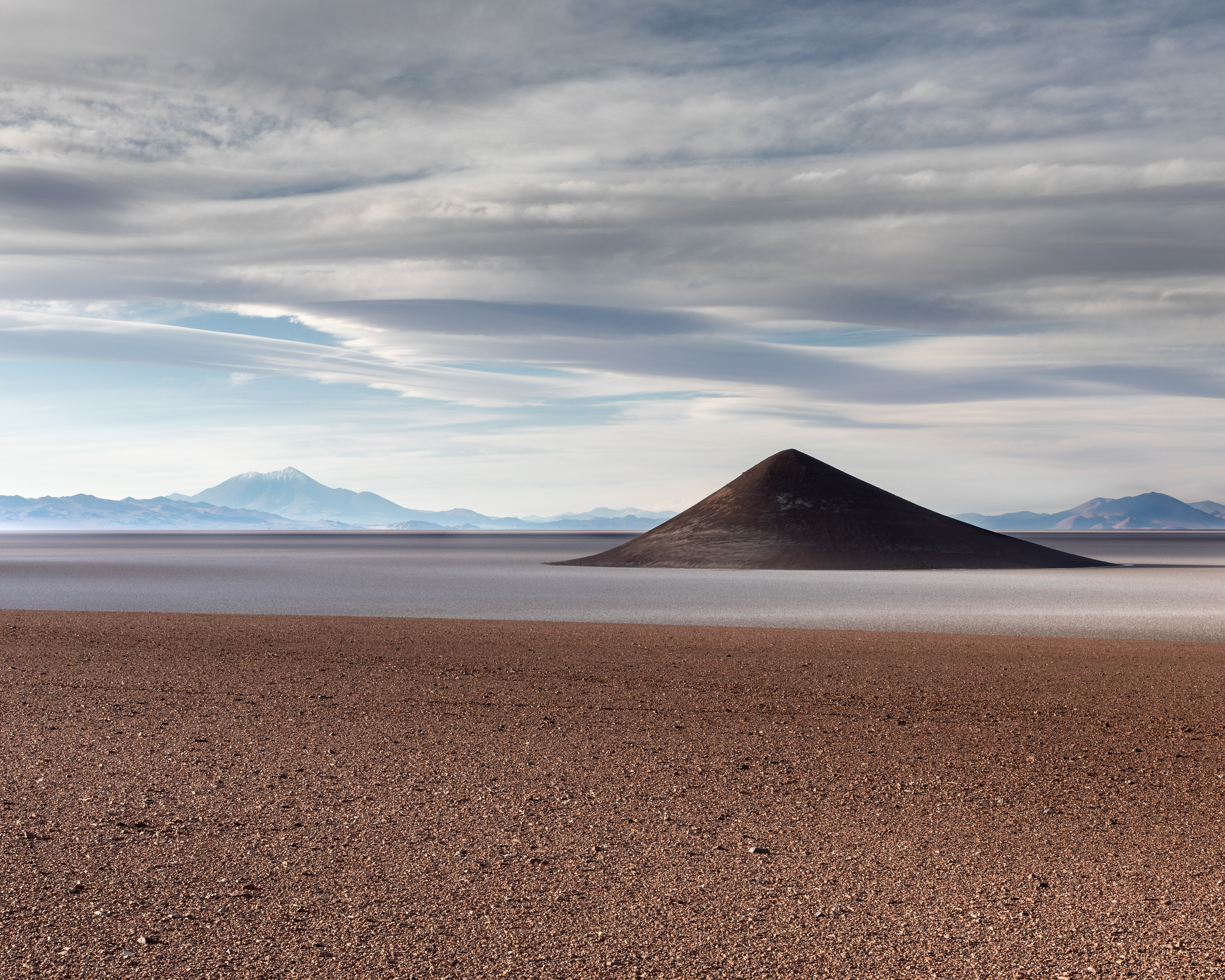
"Cono de Arita" - Atacama - 2018
5:4 Aspect Ratio
Cono de Arita is an isolated natural formation approximately 110 meters high (about the height of a 30 story building) rising out of the Salar de Arizaro. This is the 6th largest salt flat in the world. Here, the sun is setting to the left. The cone is therefore side lit which highlights its inexplicable perfect shape.
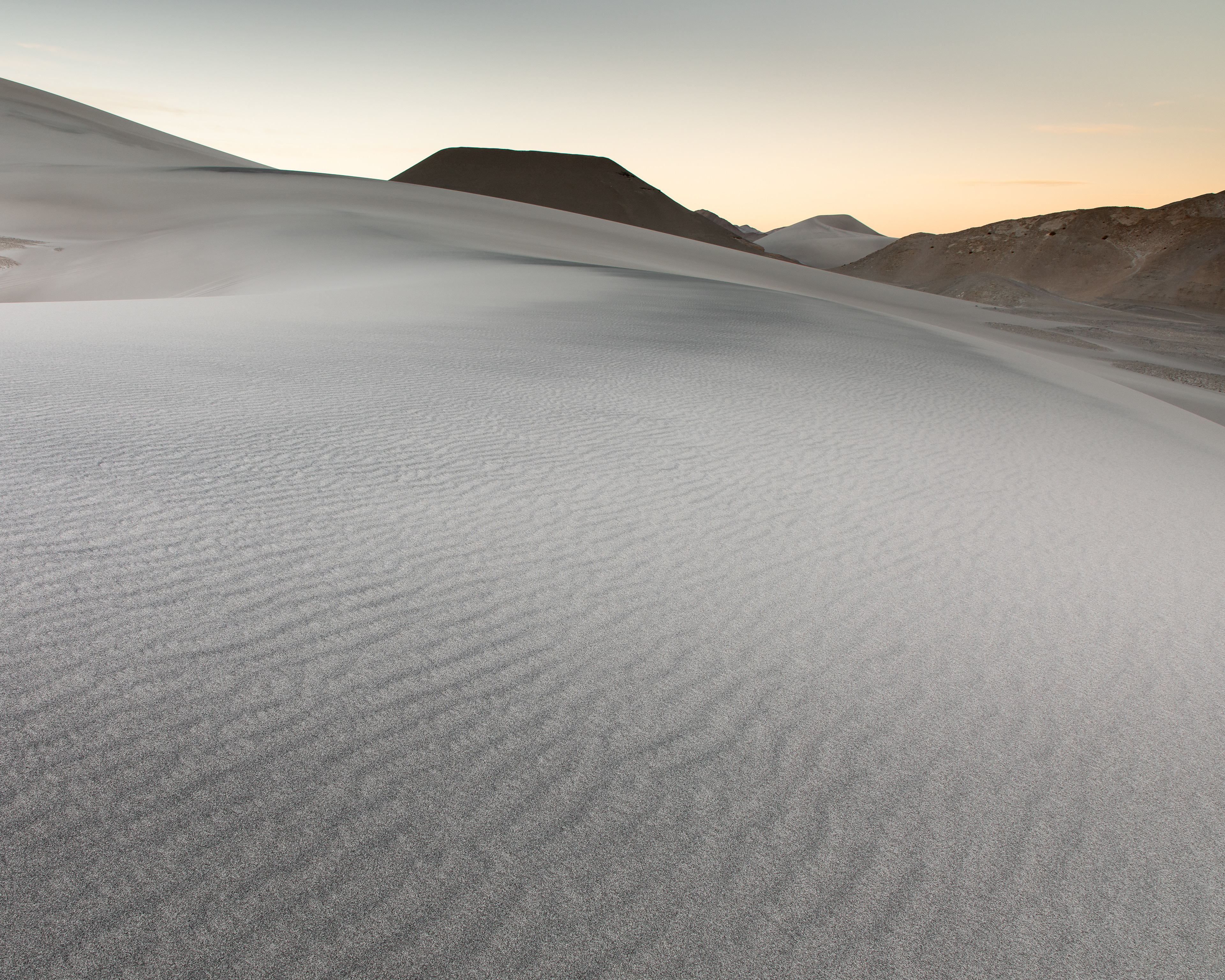
"Dunes, Study 3" - Atacama - 2018
5:4 Aspect Ratio
I've mentioned the winds of Atacama. Wind carries eroded particles for miles and miles and finally deposits them. The deposits can be in amongst other geological features that interrupt the flow of wind enough to cause the particles to drop out. This image was captured pre-dawn.
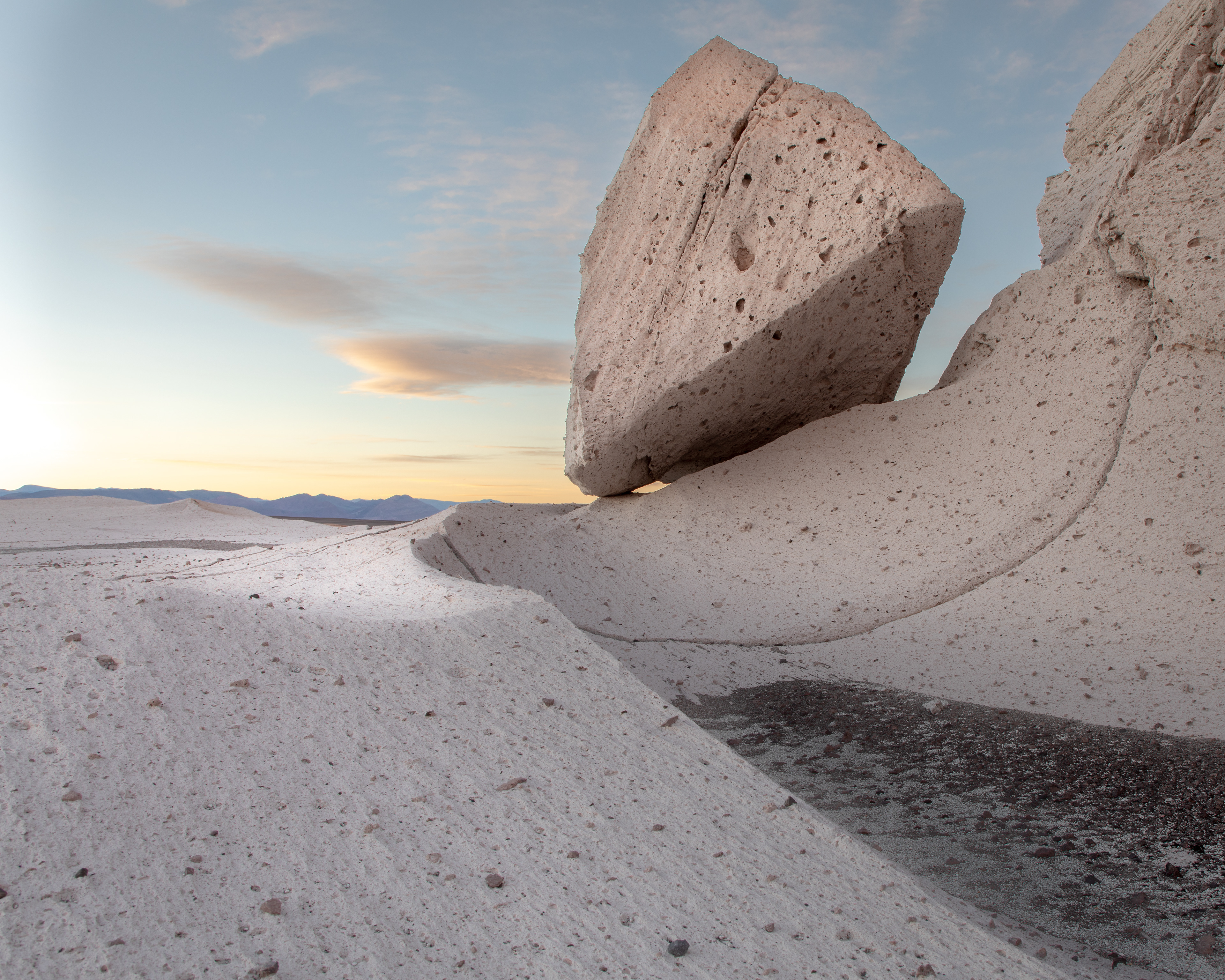
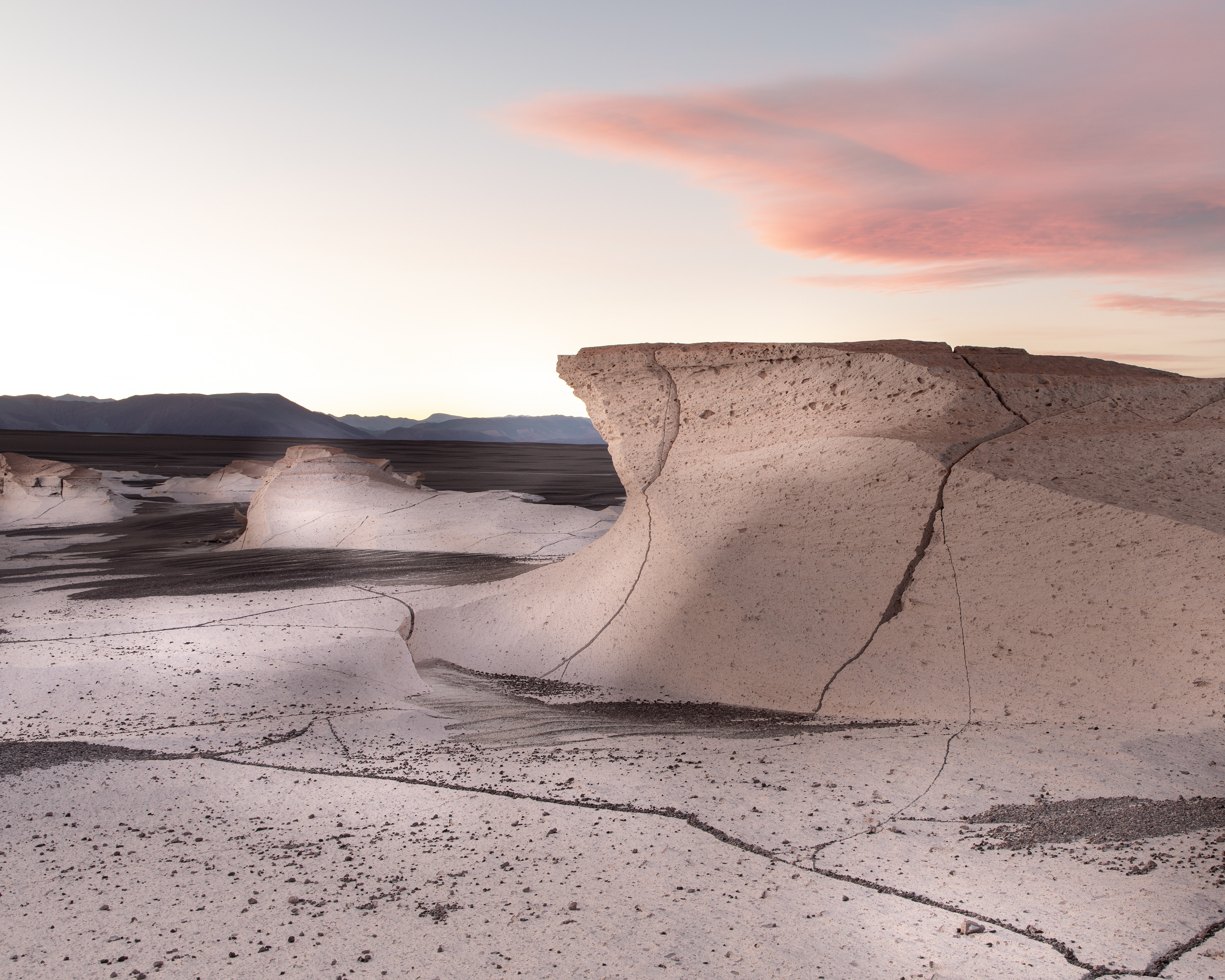
"Pumice Fields, Study 3" - Atacama - 2018
5:4 Aspect Ratio
Wind scarring is clearly visible in this image and, in this case, the under cutting was so great a giant piece broke off and came to rest at the bottom. The dark gravel to the right is the remaining aggregate carried by the wind to grind away at the pumice.
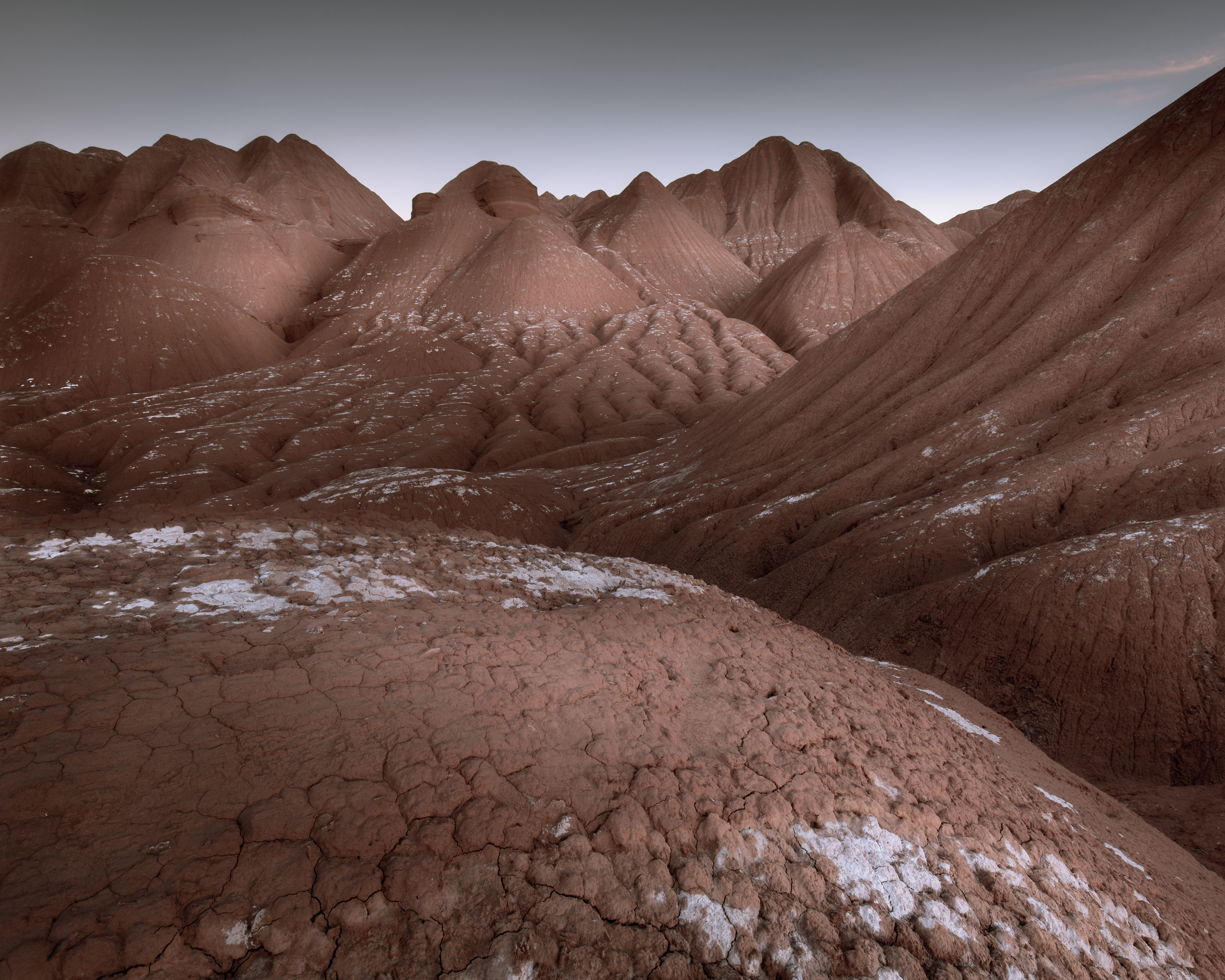
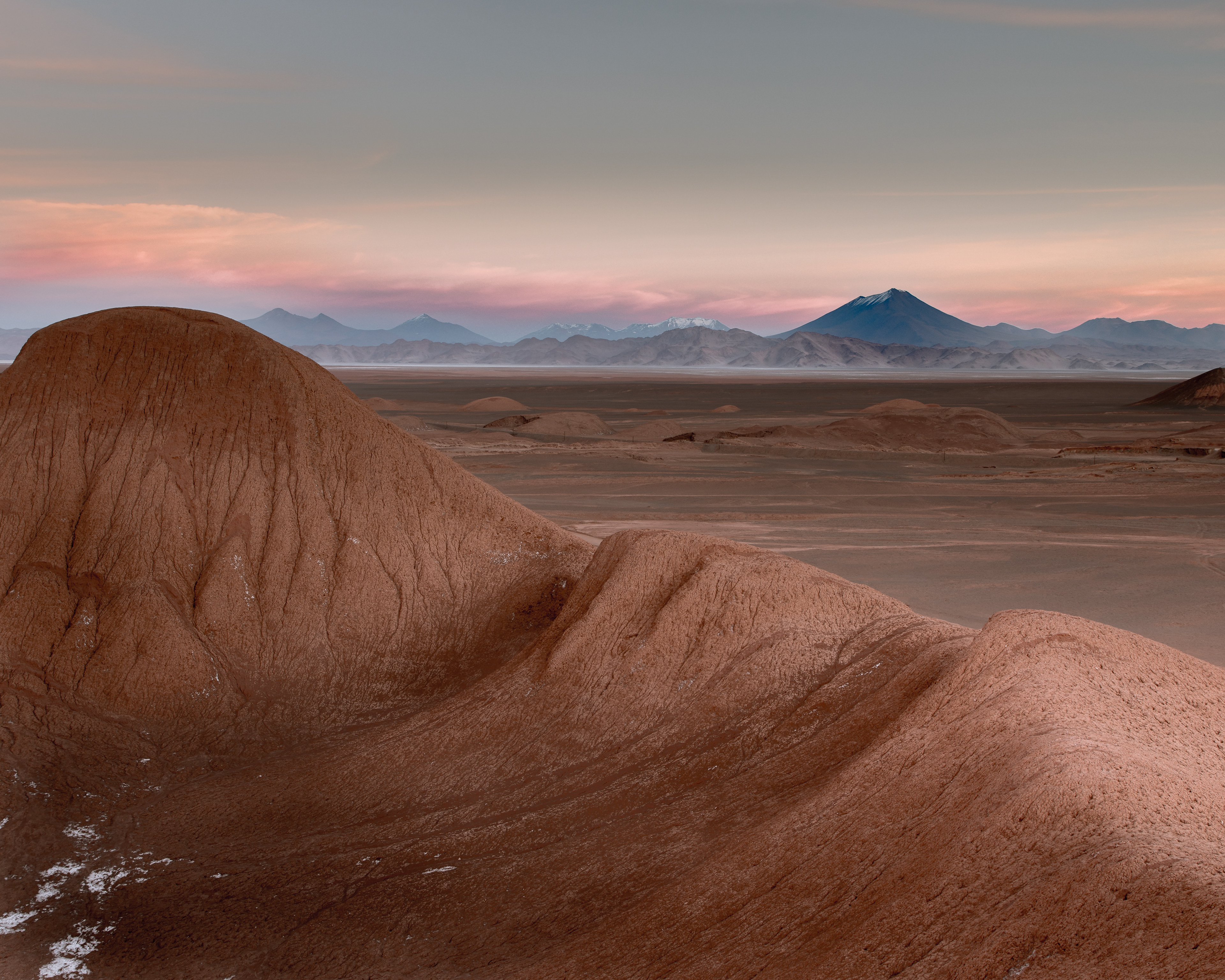
"Los Colorados" - Atacama - 2018
5:4 Aspect Ratio
The Los Colorados formation is a sedimentary rock formation deposited between 227 and 213 million years ago. This represents the late Triassic age and is notable for its fossils of early dinosaurs. It's clear that at some point it was subjected to severe water erosion although some sedimentary layers are still visible near the top of this image.
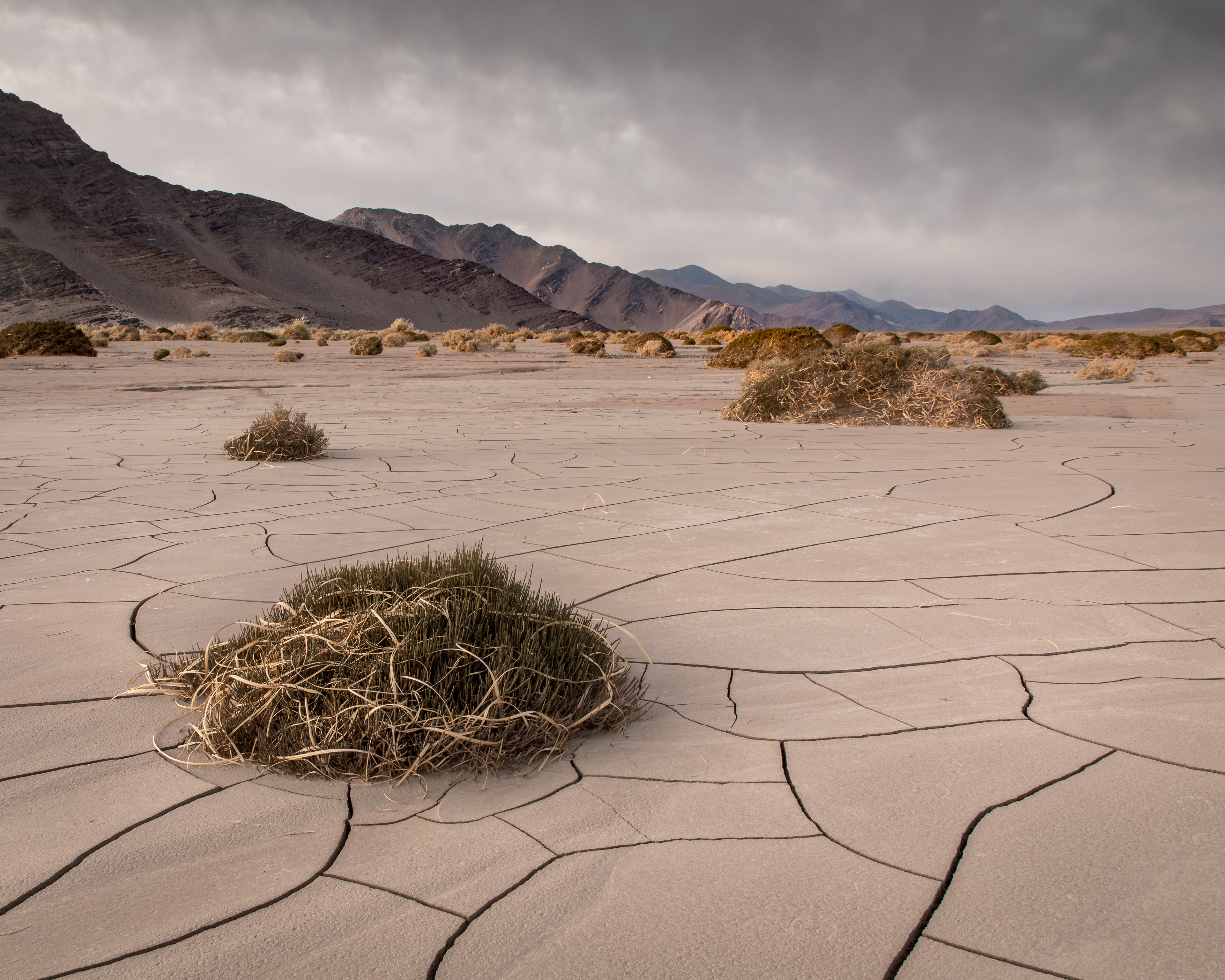
"El Penon Mud Flat" - Atacama - 2018
5:4 Aspect Ratio
This low lying area obviously gets water at times. I'm not sure what the odd plants are but they have razor sharp spines and are woody with a slight green color indicating photosynthesis is taking place. The ground surface is hard as concrete.
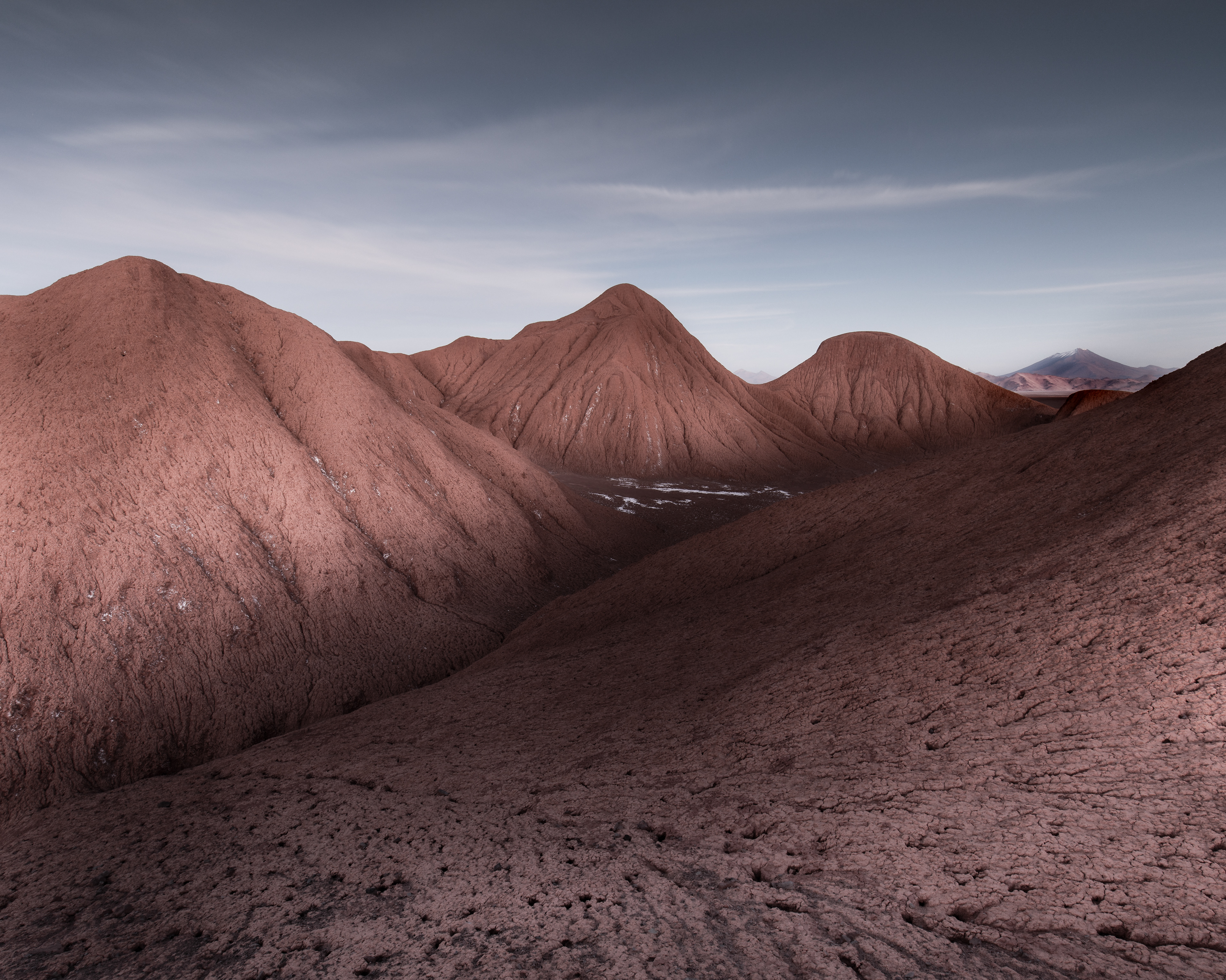
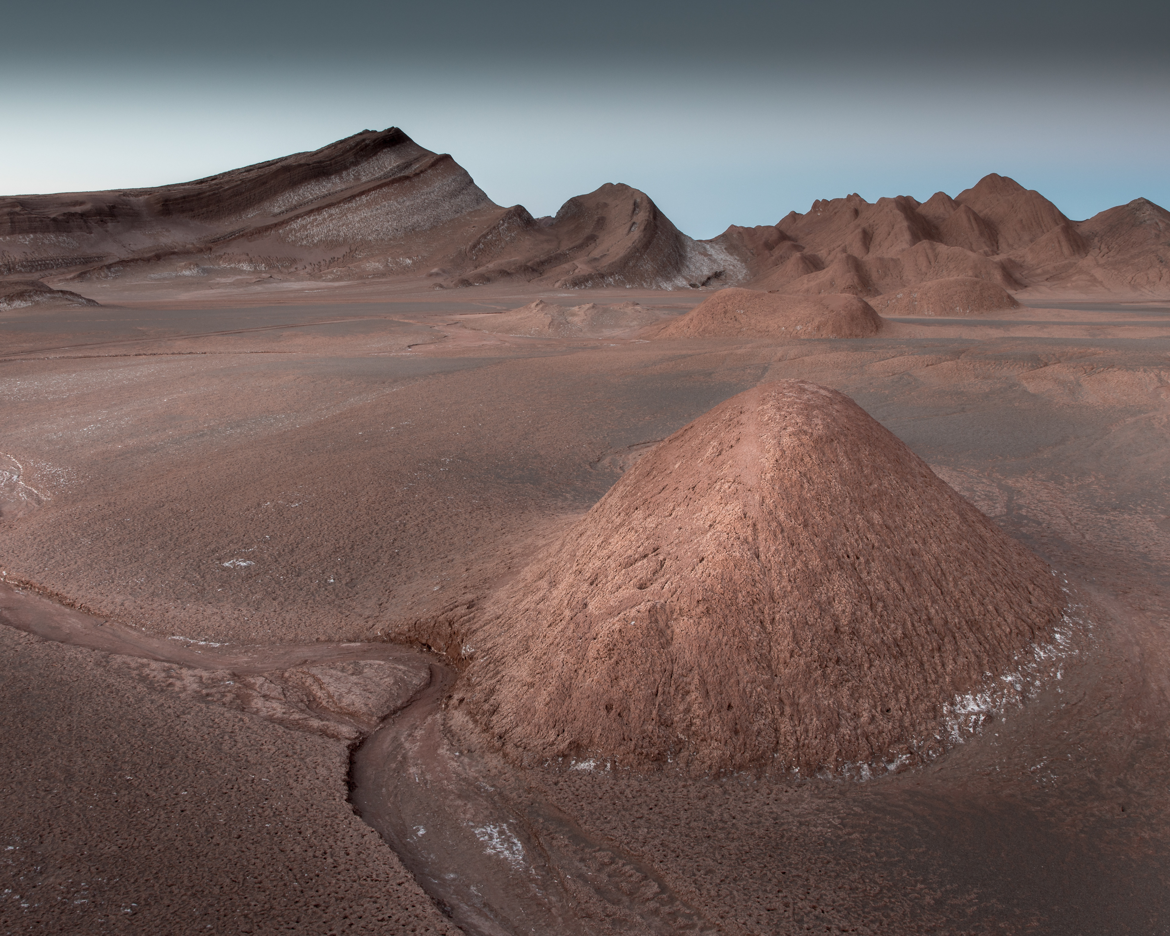
"El Arenal, Study 2" - Atacama - 2018
5:4 Aspect Ratio
In the Tolar Grande region, these enormous mountains of salt and sand combine to create a wide variety of very unusual formations.
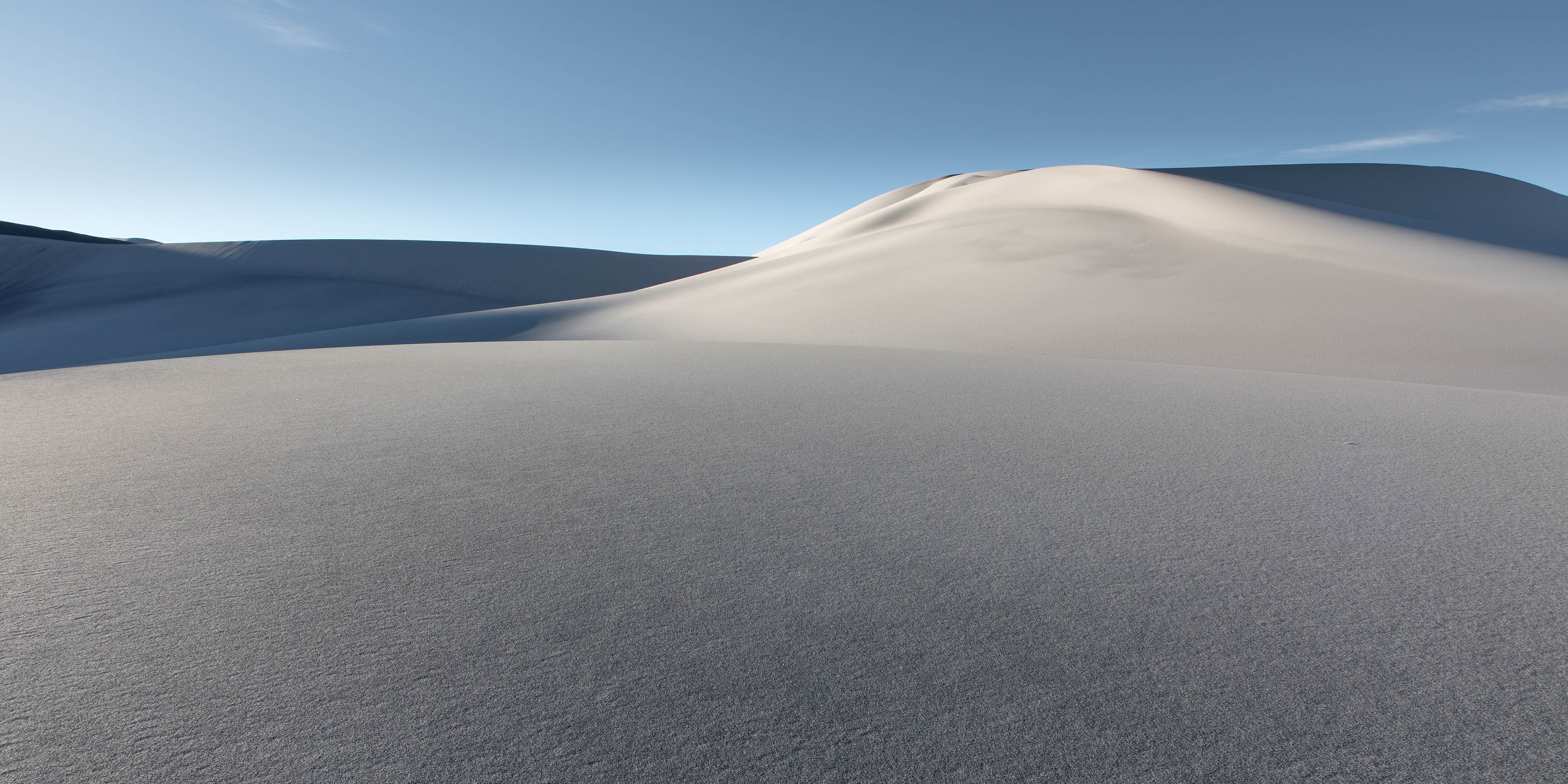
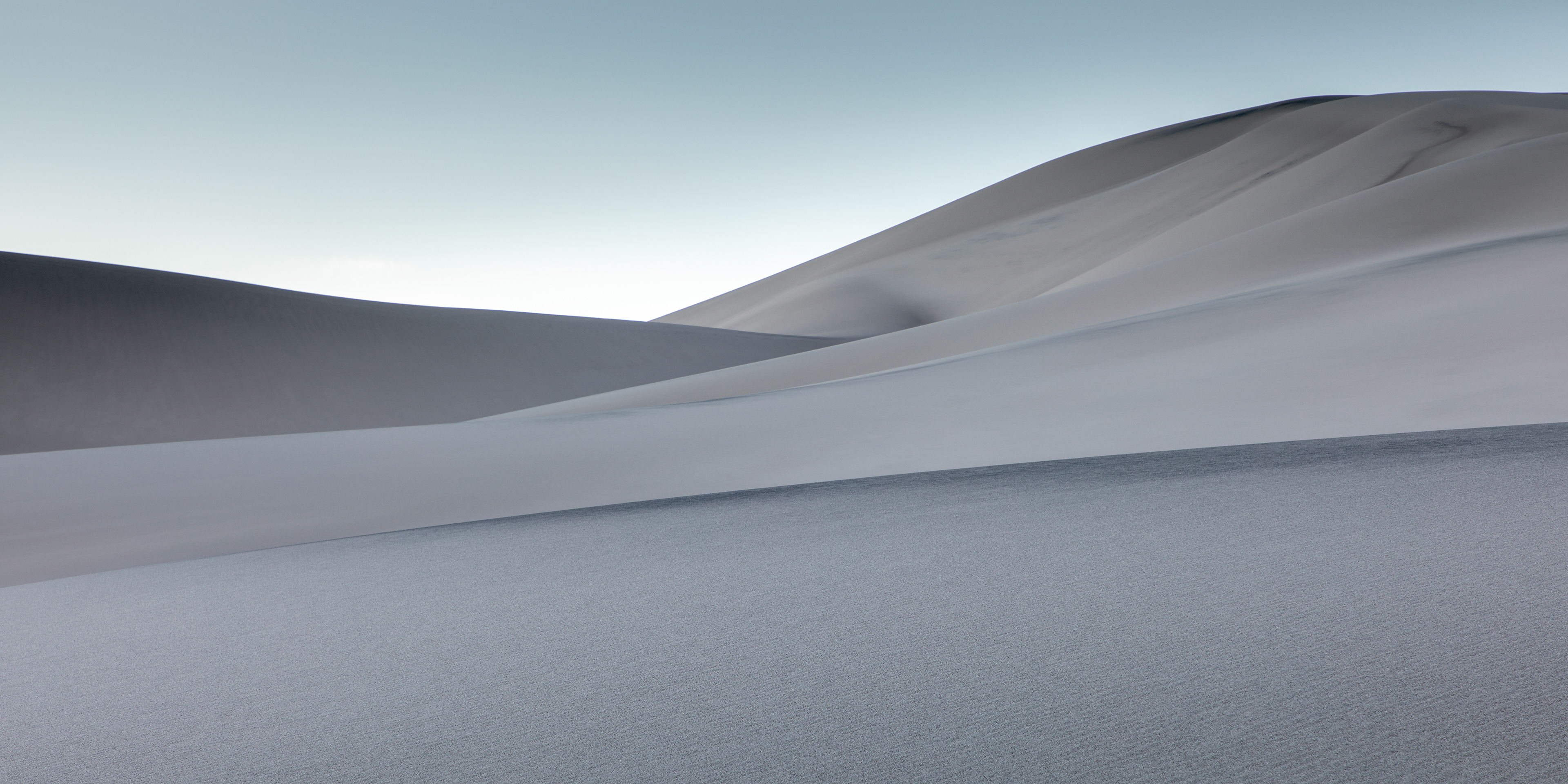
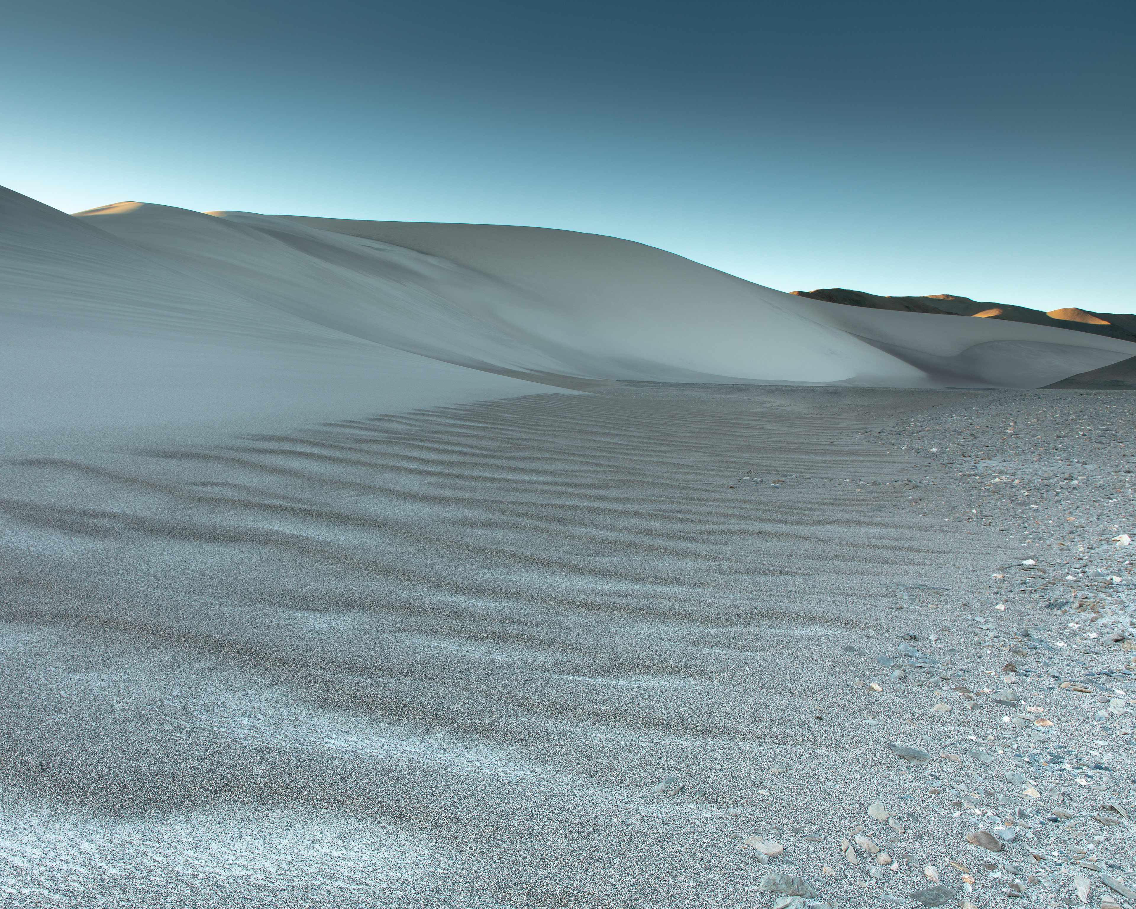
"Dunes, Study 1" - Atacama - 2018
2:1 Aspect Ratio
Wind erosion is massive in the Atacama. Eroded particles carry for miles and miles until finally deposited in these dune formations. This image was captured just as the sun cast its first light over this mound which I would guess to be about 200 feet high. This is a 2:1 image which would make a beautiful panoramic print.
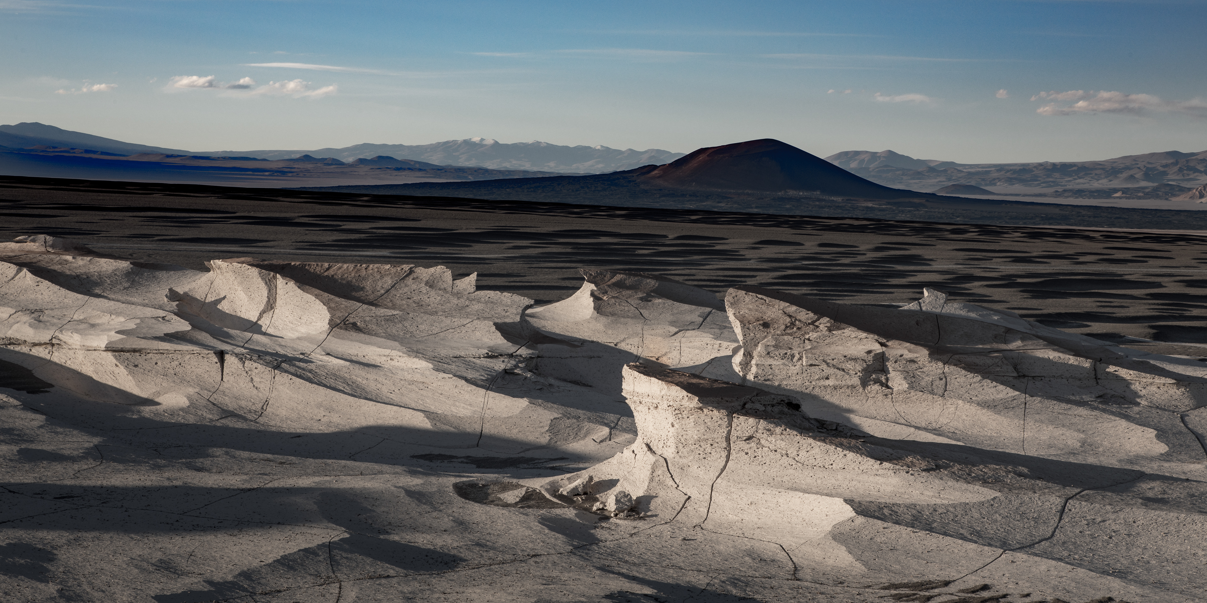
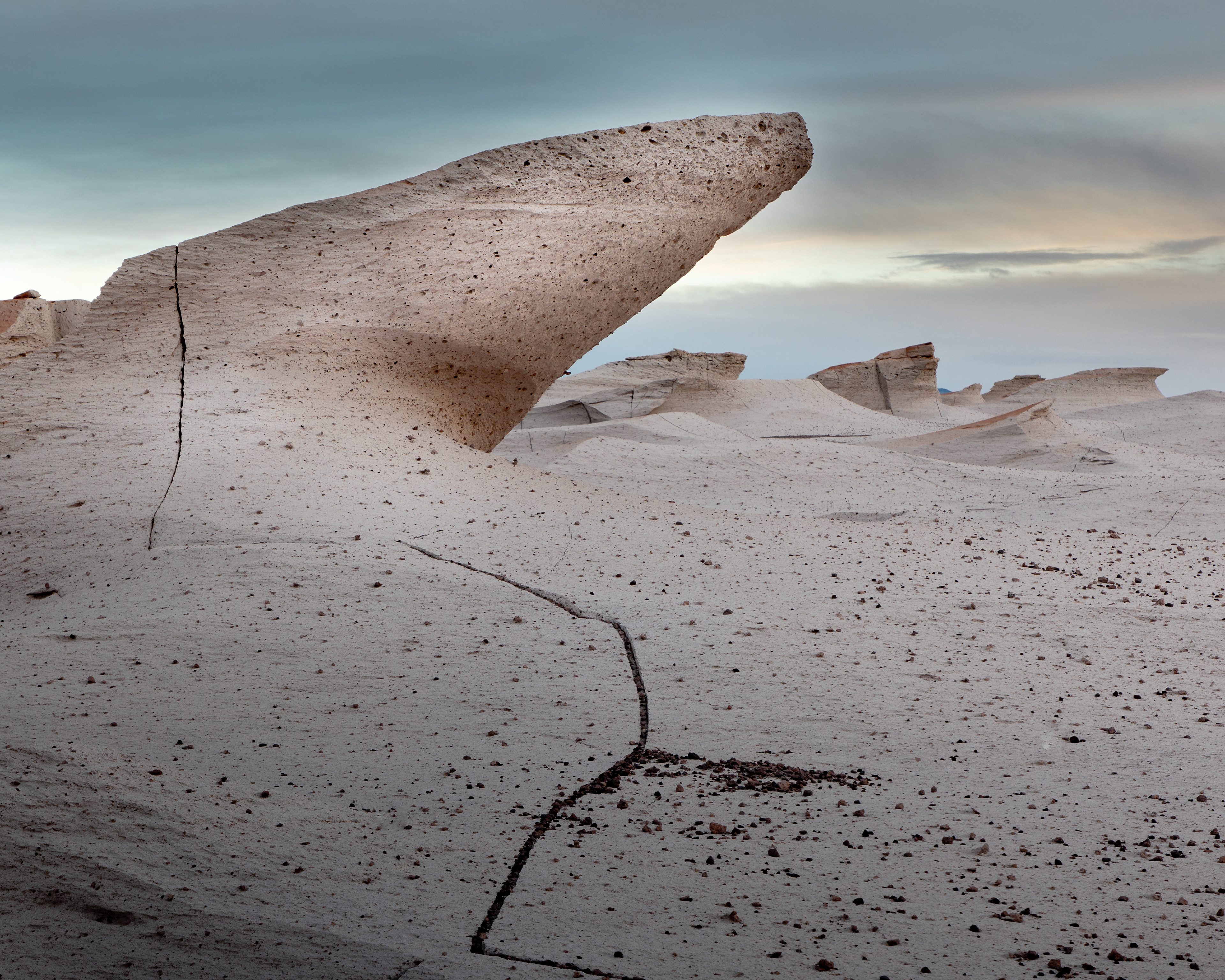
"Pumice Fields, Study 1" - Atacama - 2018
2:1 Aspect Ratio
Giant fields of pumice stone were volcanically created here millions of years ago. The stone is literally rock, but is exposed to the erosion of high winds that occur here regularly. This image shows the clear horizontal erosion of the rock. I believe the large volcano in the background is the original source of the pumice.
"El Arenal, Study 1" - Atacama - 2018
5:4 Aspect Ratio
Again, the El Arenal near Tolar Grande. Other worldly view.
"Dunes, Study 2" - Atacama - 2018
2:1 Aspect Ratio
Another example of the interesting patterns created by wind currents which are finally giving up their cargo of sand and other particles eroded miles away.
"El Arenal, Study 3" - Atacama - 2018
5:4 Aspect Ratio
This version of El Arenal shows an unusual pushed up sedementary layer of salt, obviously once ocean floor, that is still intact. The image was captured from atop a higher hill giving the perspective of looking down upon the plain. The mound in the foreground is perhaps 100' high
"Pumice Fields, Study 2" - Atacama - 2018
5:4 Aspect Ratio
The pumice fields go on for miles and miles. Wind takes its toll, scarring every surface, wearing it down and creating very crazy shape imaginable.
"Dunes, Study 4" - Atacama - 2018
5:4 Aspect Ratio
In this version of "Dunes" one can clearly see the effect of wind eddys in the boundary between rock and dune.
"Pumice Fields, Study 4" - Atacama - 2018
5:4 Aspect Ratio
This was taken in the evening. It was absolutely dead quiet. There was no wind or sound at all. Notice the pink cast in the rock. I found that when there are pink and red hues in the sky, it often shows up in everything else.
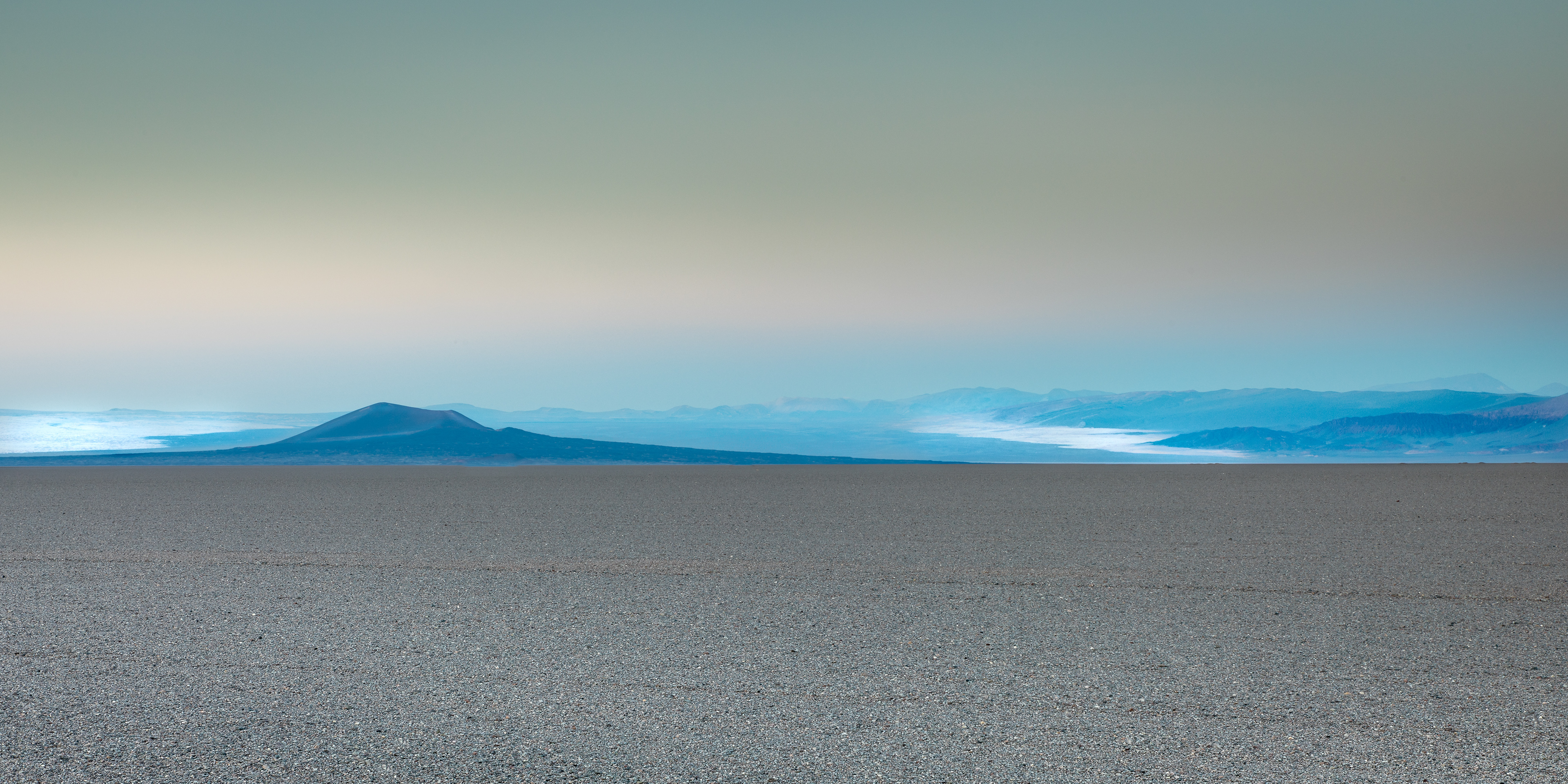
"Black Volcano" - Atacama - 2018
2:1 Aspect Ratio
This was taken before sunrise and is a good example of a clearly visible earth shadow. Notice the blue layer with a pink/yellow layer above it. The border between those layers is the earth's shadow line. As the sun rises, that line will drop and disappear. So I like to think of the blue as twilight light and the pink as pre-dawn light. In this moment, you see both.
This black volcano is actually one of hundreds in the Atacama. This image was captured perhaps 30 miles away across a flat plain of gravel. You can see salt flats on either side of the volcano. That's not water!!
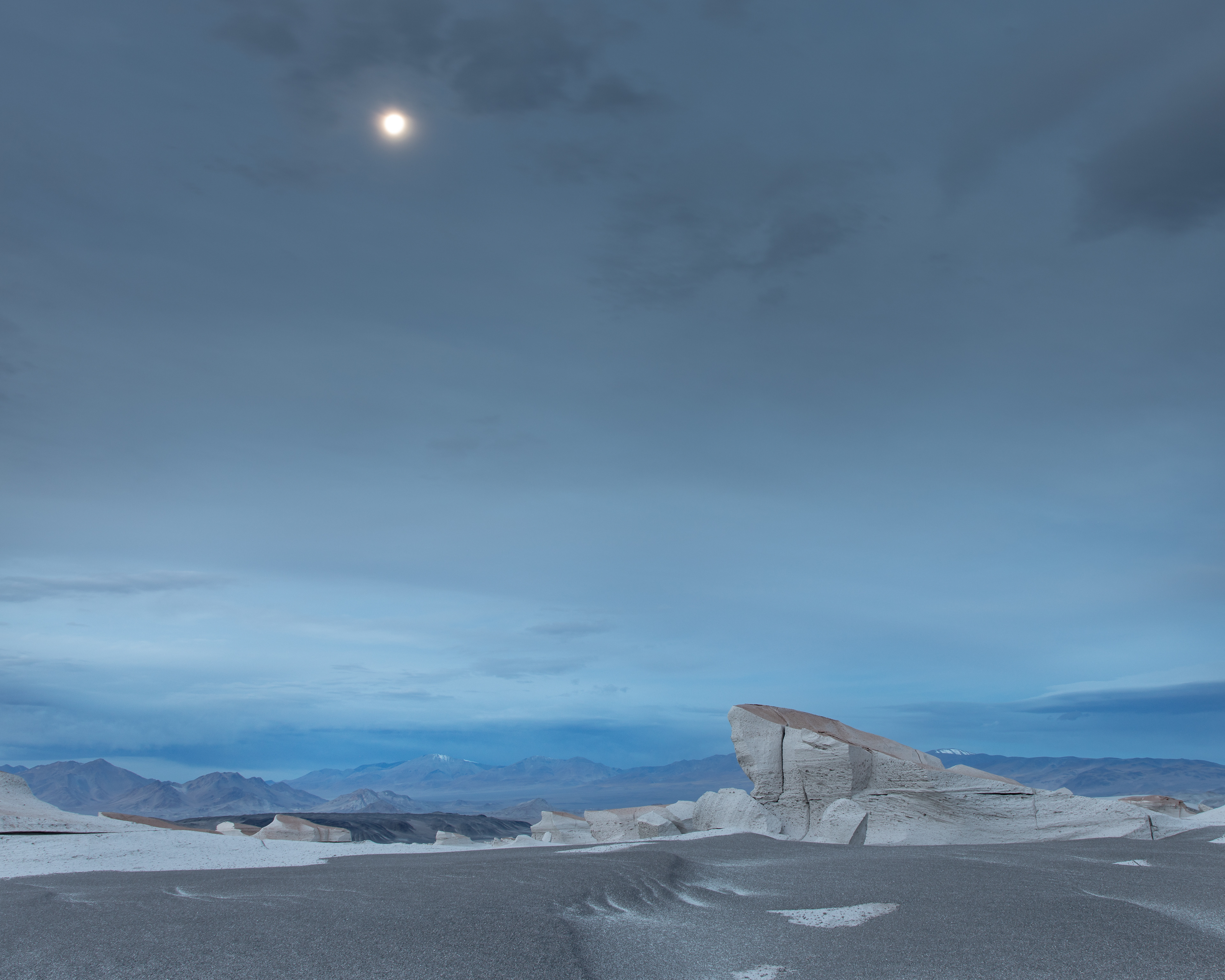
"Atacama Moonlight" - Atacama - 2018
5:4 Aspect Ratio
This was taken well after dark as we were making our way back to the trucks by headlamp light. The moon was out full. I stopped to capture this image. It was a full 30 second exposure, but really caught the blue twilight atmosphere. There was enough moonlight to somewhat light the landscape. I love the picture.
Here are a few travel photos......
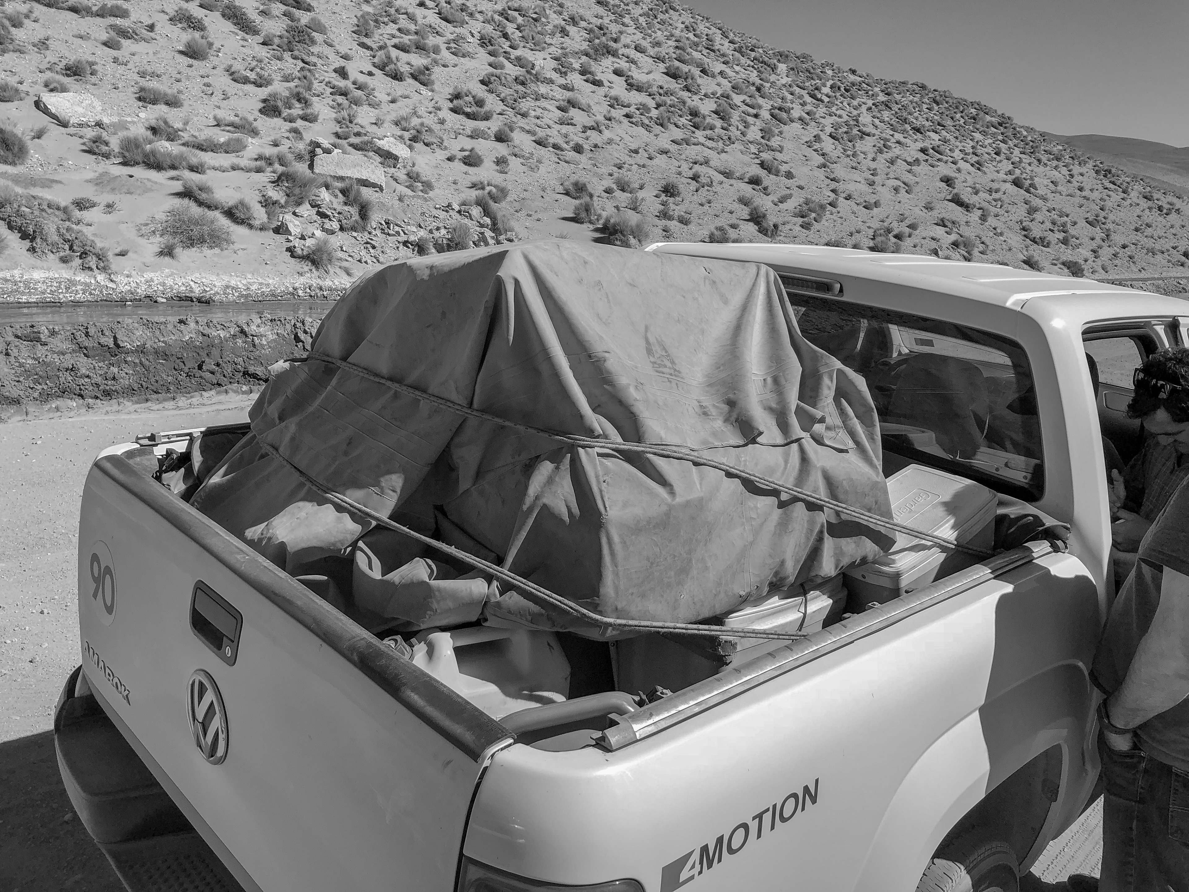
Dirt and dust is everywhere. It gets into everything! Gear to be kept somewhat clean was wrapped in canvas. Notice the jerry cans of fuel also in the truck.
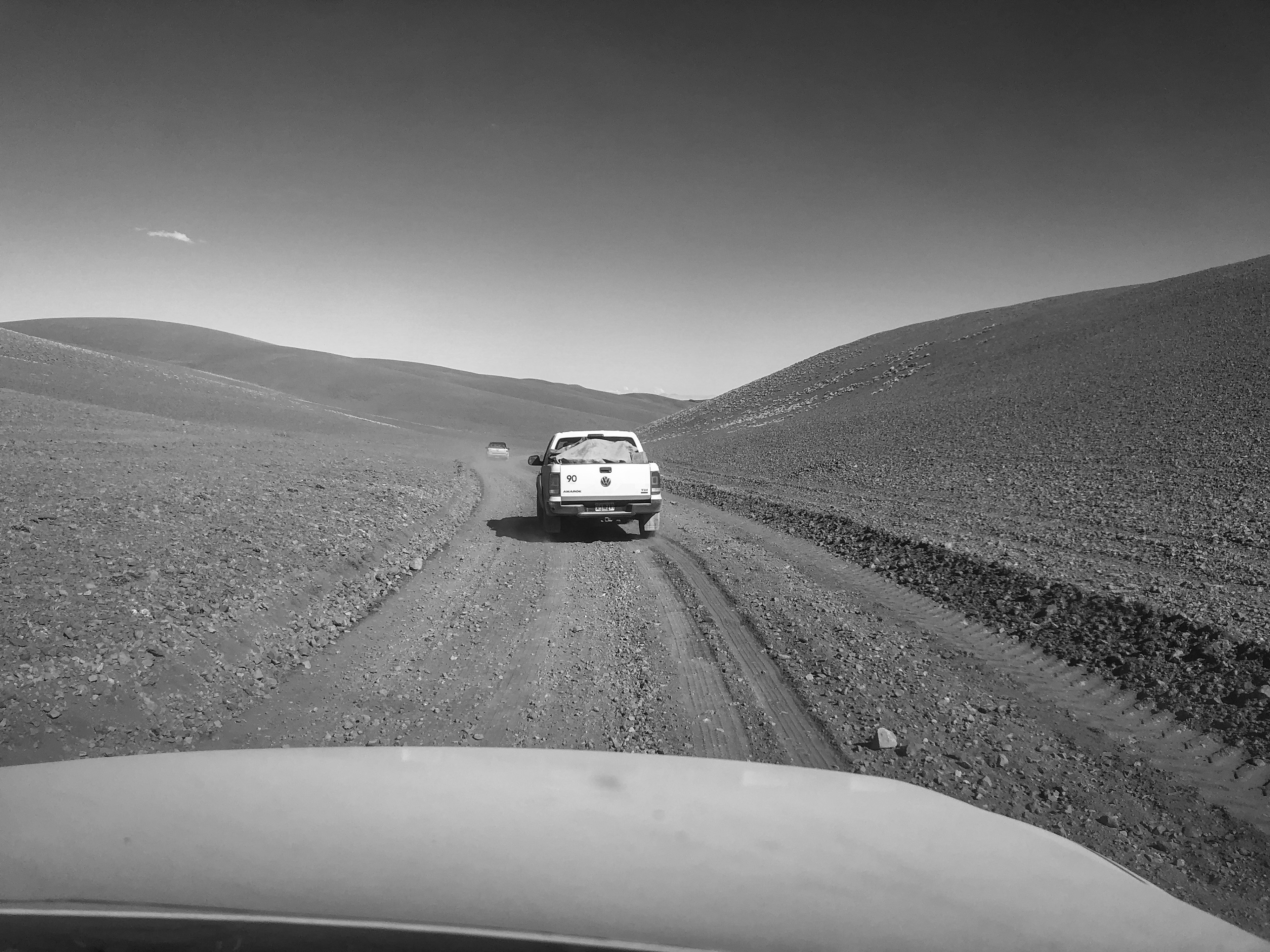
This is what the roads were like. Actually this is a nice stretch because it's more gravel that rocks.
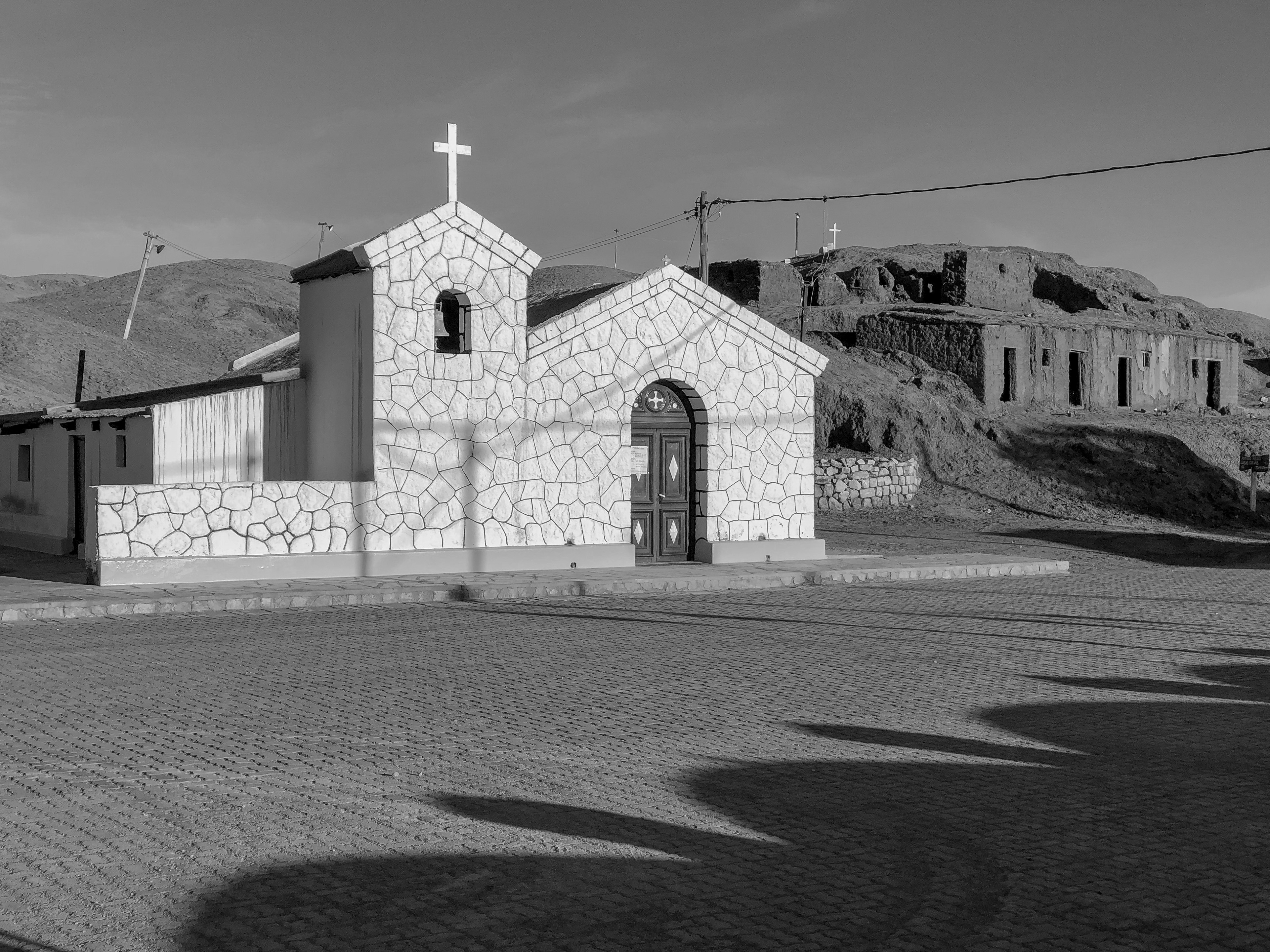
Small villages were usually associated with a spring or well of some kind that could get water. Usually electricity came from a local generator and was turned on in the evening. Every village had a small church like this.
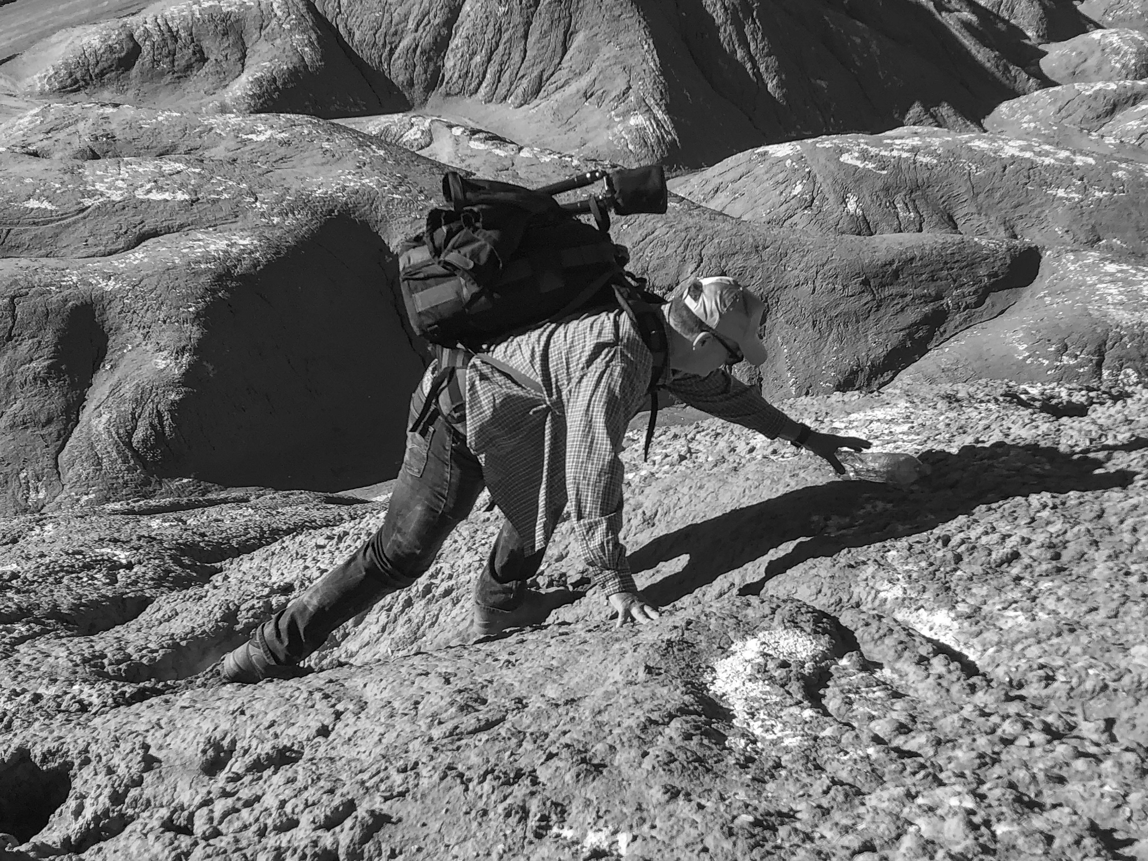
There was considerable amount of climbing at times.
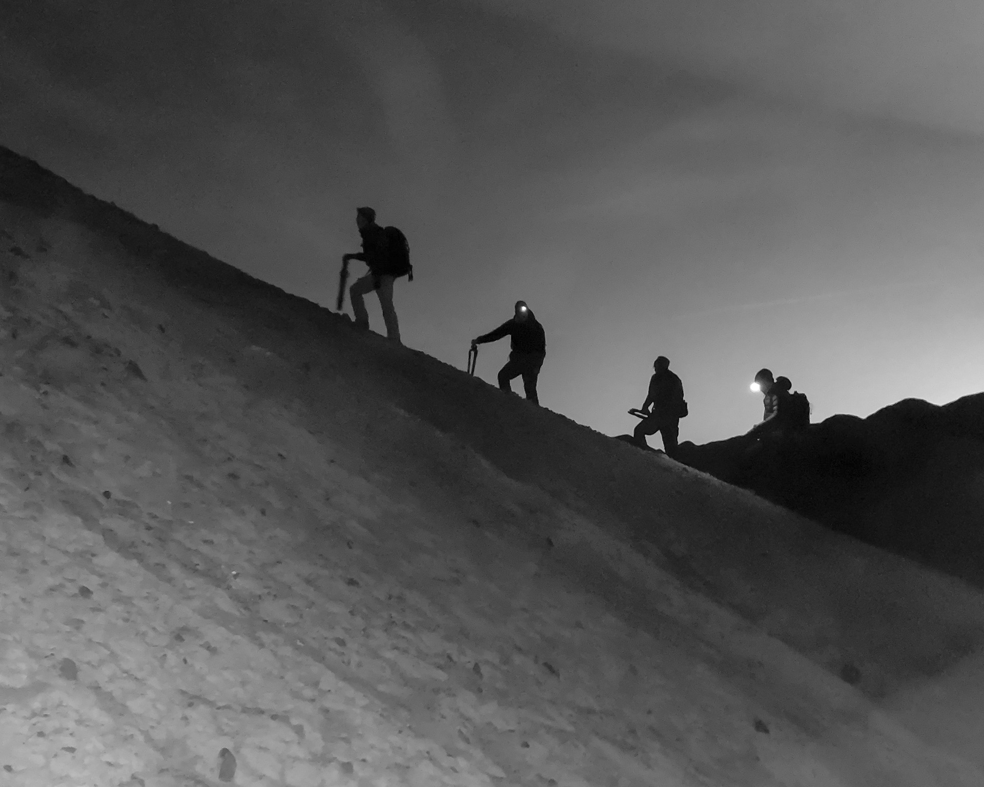
Often we were hiking and climbing in the dark. This was taken about 45 minutes before sunrise.
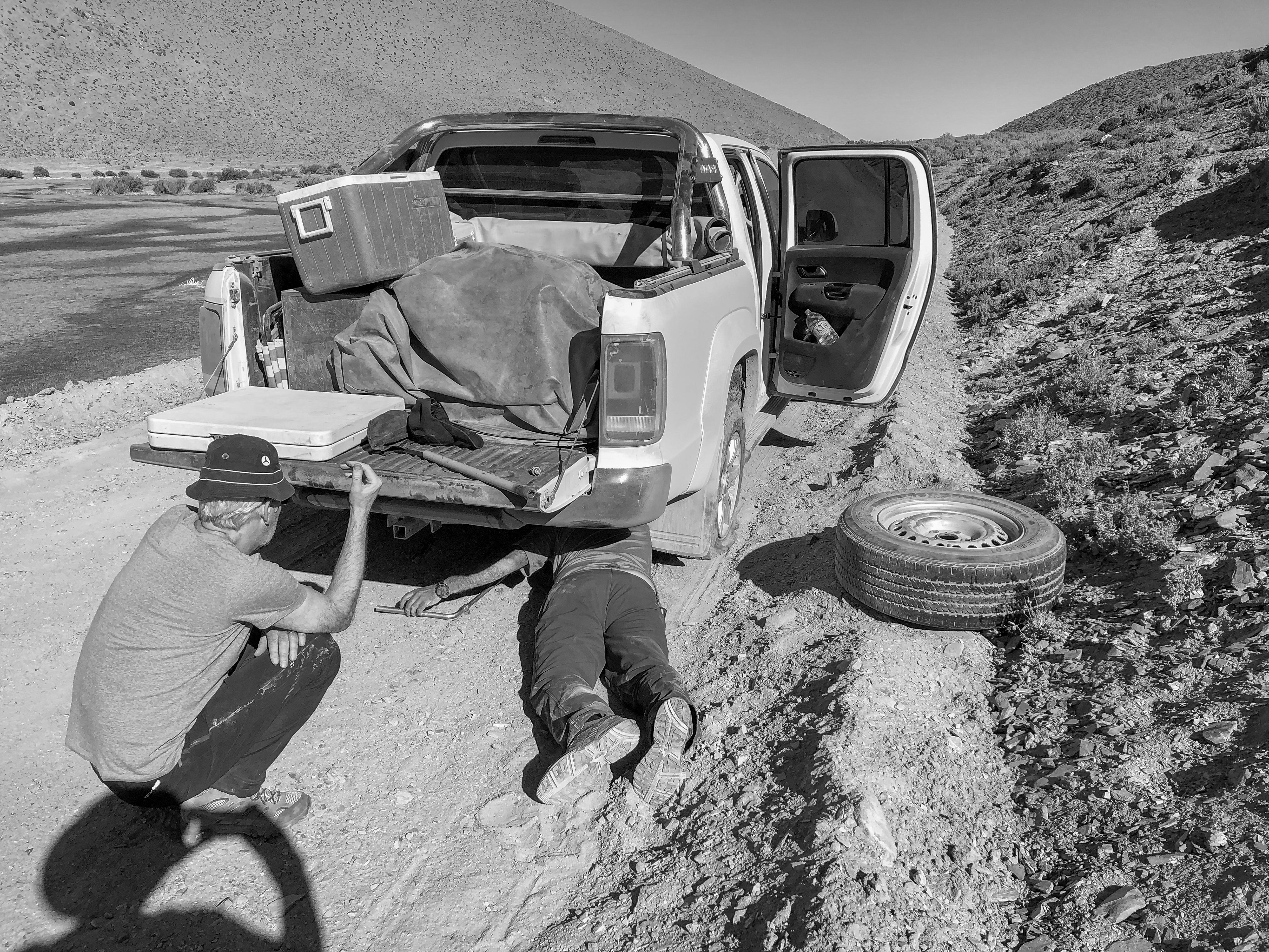
We didn't have a lot of mechanical breakdowns, but it does happen. The tire was a complete blowout punctured by a sharp rock.